
🌿 Seoul Trail — Complete Guide
✨ What is the Seoul Trail?
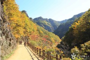
The Seoul Trail (서울둘레길) is a 156.5 km hiking course that forms a complete loop around the city.
It is divided into 21 sections and connects mountains, forests, streams, and peaceful urban parks.
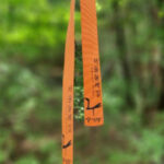
Marked with the signature yellow and green ribbons, the trail is beginner-friendly and perfect for
a relaxing escape from the busy city.
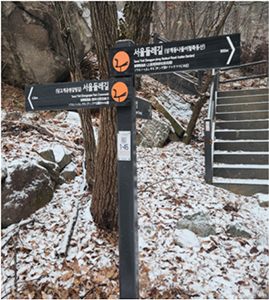
Direction
🌲 Why the Seoul Trail is Special
- A full hiking loop circling all of Seoul
- Easy sections for beginners, challenging ones for experts
- Hidden temples, forest paths, village roads and viewpoints
- Perfect for after-work walks or weekend hikes
- Ideal for solo hikers and expats
- Includes the popular Stamp Tour
-
- Direction
-

- Direction
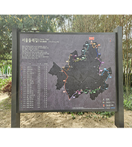
📍 How the Seoul Trail is Organized
The Trail is divided into 8 major zones, each containing multiple sub-sections:
1. Bukhansan Section
2. Dobongsan Section
3. Suraksan Section
4. Samseongsan Section
5. Gwanaksan Section
6. Cheonggyesan Section
7. Buramsan Section
8. Anyangcheon & Han River Section
Each segment includes distance, estimated walking time, start/end points, difficulty level and nearest public transportation.
You can easily pick a route depending on your time and energy.
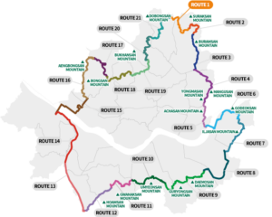
Map
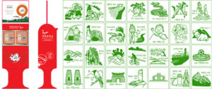
🏅 Stamp Tour (Knock Stamp Mission)
One of the highlights of the Seoul Trail is its stamp collecting mission.
Along the trail, you’ll find official stamp boxes where hikers can collect stamps in their booklet.
Once all stamps are collected, Seoul City awards a Certificate of Completion.
It adds a fun and motivating challenge to every hike.
Stamp
Where can I get the passport for the Stamp Tour and the trail map?
| Distributor | Contact |
|---|---|
| Seoul Trail Information Center (Seoul Iris Garden) | +82-2-779-7902~7904 |
| Open Civil Service Center (1F, Seoul City Hall) | |
| Seoul Trail Information Center (Maeheon Citizen’s Forest) | +82-70-4465-7905 |
| Achasan Mountain Information Center | +82-2-450-1655 |
| Gwanaksan Mountain Information Center | +82-2-879-6552 |
Seoul Trail features 28 stamping stations made from repurposed mailboxes along the trail. Each of the 28 stamps creates a memory for visitors as they walk the trail, much like how the mailboxes once delivered the messages of the people who used them.
The stamps depict different historical, cultural, and environmental images you can see as you travel along the trail. The memories created with each stamp you collect will remind you of the routes you took and the stories of Seoul that they hold, allowing you to directly feel the hidden stories of the city with every step you take.
Those who collect all 28 stamps (through the stamp book or an app) can receive a Seoul Trail Completion Certificate.
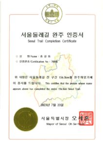
Certificate
🚇 How to Access the Trail
The Seoul Trail is designed to be extremely accessible.
Most sections start or end near subway stations or bus stops.
- Bukhansan Dullegil Entrance
- Dobongsan Station
- Suraksan Trailhead
- Gupabal Station
- Anyangcheon Stream Park
Map
💡 Tips Before Starting
- Bring enough water (some segments are long)
- Wear comfortable hiking shoes
- Check the weather
- Download Naver Map for navigation
- Follow the yellow & green trail markers
- Start with an easy section if it’s your first hike

Trail 19
📌 Who Is the Seoul Trail For?
- Solo hikers
- Couples looking for quiet escapes
- Expats wanting new weekend activities
- Nature lovers
- Photography and video creators
- Anyone wanting to explore Seoul differently
ⓒKorea Tourism Organization – Park Seonggeun